
")


Nature of Nazaré

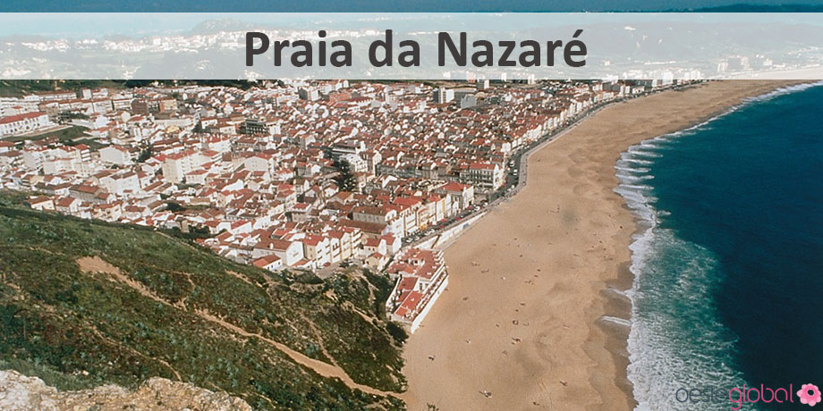
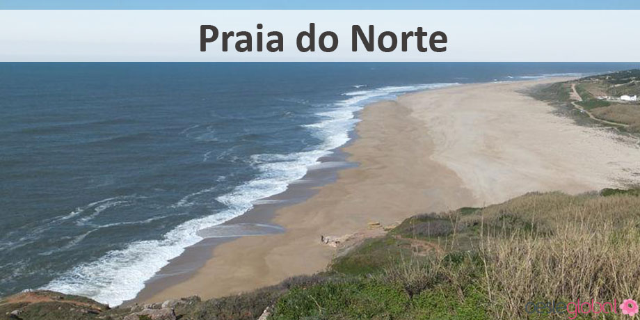
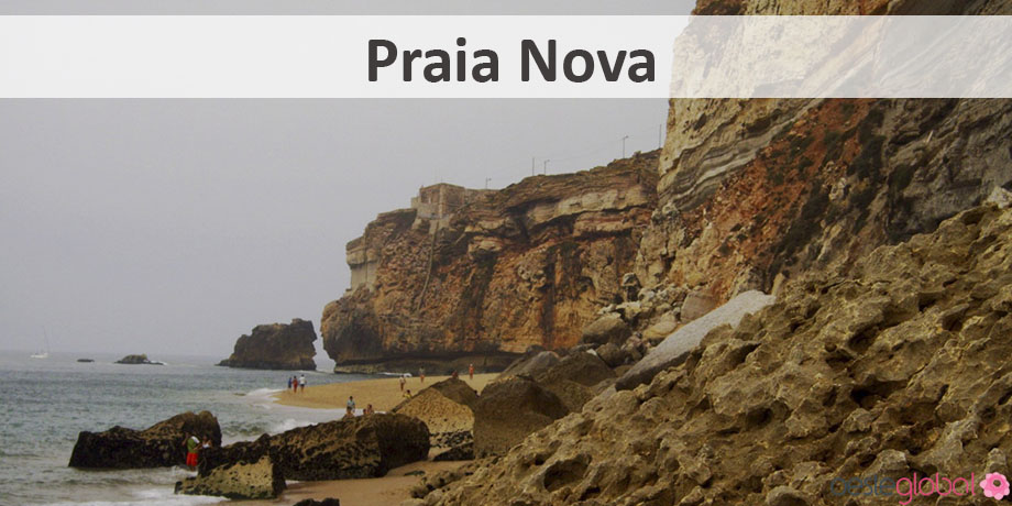
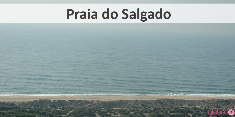
In the municipality of Nazaré features a beautiful natural heritage. Renowned for its beaches, especially due to the current phenomenon of wave of North Beach. Throughout the Nazaré county’s coastline we find a heritage that preserves the history emerged as the county, such as:
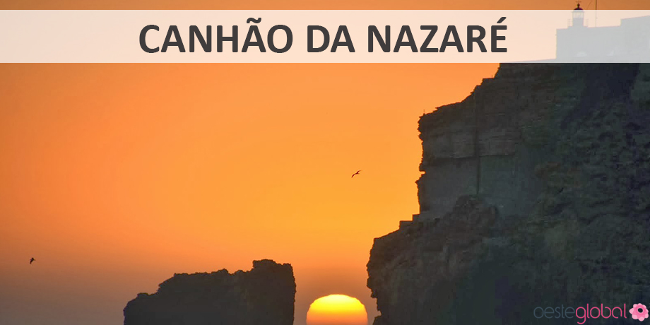
Nazaré Canyon– this submarine valley is Europe’s largest and considered one of the largest in the world. Intercalated with the continental shelf extends for over 170 kilometers and can reach a depth of more than five thousand meters in the abyssal plain, where this cannon empties. This geomorphological event of tectonic origin binds with failure of Nazaré-Pombal, defining from the 500 meters of the coast. Your underwater throat can cause changes in sedimentary coastal traffic, as this gun is like a sink for sediment coming from the north, the coastal drift, and the justification for the absence of a large areal extent in the south of Nazaré beaches.
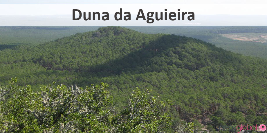
Aguieira dune – the largest consolidated dune in Europe, this was a candidate for Classified Site in 1979, together with Mount St. Bartholomew. However, even though recognition, it has not been declared as Geomonumento. This sedimentary formation comes from sand to the north of Nazaré, its preservation may be interconnected with the planting of the Leiria pine forest. The altitude these dune formations could be related to the lifting of the western flank of diapiro of Caldas da Rainha.
Pedralva ou White hill – It lies in eastern Nazaré area and is a formation whose lithology is composed of white sandstone, sometimes coarse, cauliníferos and varying with micaceous levels / muscovite and some more conglomeratic levels arrive whose reach 30 cm in diameter. Its area is like a garden, and at its highest point possible to verify the panoramic views of Nazaré.
Pederneira Lagoon/Valado-Cela fields – the floodplain of Cela / Valado dos Frades and Maiorga, accompanied by the Serra da Pescaria, the west and the hills Bárrio the east, had once been occupied by a laugh that turned into a lagoon estuary, called Lagoa da Pederneira.
Promontory of Nazaré – a sedimentary rock formation, related to geodynamic events elapsed between the Upper Cretaceous (Cenomanian) and the Eocene, since the Cenozoic. The sediments present at the base of this formation are from marine rocks with fossil-rich features, and its top has alluvial, fluvial and continental rocks. On top of Promontory, relatively close to the Fort of San Miguel, you can find a filoniano complex olivínicos basalts correlated with Basaltic Complex of Lisbon.
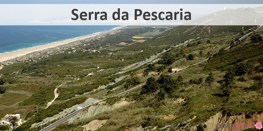
Moutain of Pescaria – located south of Nazaré, this mountain contains the oldest rocks of the Nazaré region, with about 154 million years, with deposits of Upper Jurassic, which has a link with the tectonic activity related to the second phase of rifting the opening of the Atlantic ocean and the separation of Pangaea supercontinent. The structure itself saw had tectonic changes due to diapiric intrusion of Caldas da Rainha.
The magmatic formation known as São Brás hill ou São BartolomeuAs formerly Monte Seano, still remains a place of pilgrimage and religious festival of the people of the region. It is a classified site since 1979 due to its endemic flora typically Mediterranean, the geology of igneous origin, emerging from a distinctive way, and its scenic and historical value.
Pederneira Pillory-fossil – trunk portion of a silicified gymnosperm, having been erected in place of the old pillory Manueline. It offers a diverse taphonomic history and cultural significance closely related to the town of Pederneira. It is one of the most important monuments of Nazaré. The name of the village of Pederneira will come from this trunk fossilized conifer, found in the region.