")


Natural Reserve of Sapal in Vila Real de Santo António
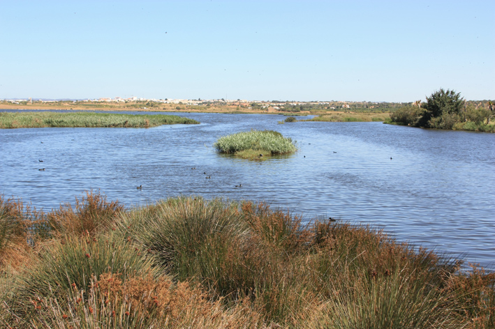
The Reserva Natural do Sapal extends along along the Guadiana River between the village of Castro Marim and Vila Real de Santo António, covering an area of 2090 hectares. This area consists of wetlands zone of saline, salt marshes and estuaries and rural sands, shales and red sandstone, which are accompanied by numerous sedentary and migratory waterfowl, such as the Royal Duck (Anas platyrhynchos) and Flamingo (Phoenicopterus ruber) and unique plant species tolerant to high salt content (Spartina maritima). This book contains an environmental itinerary and an Information Centre which offers a panoramic view of the marshland. This area includes several habitats such as salt marshes, salt, brackish and freshwater marshes, ditches and creeks, which together form a network of canals and flooded areas. Currently, these are the best preserved landscapes of the entire coast of the region, because of its poor human intervention, which safeguarded the natural and pure beauty of the Guadiana river, the extensive mudflats and alfarrobais. In this book, the dominant vegetation is halophyte that its features enable their survival in saline environments with cyclical flooding, the bunds of salt are populated by small shrubs that favors the protection of birds, seeking this area for nesting grounds as the Kentish Plover, little tern, Taylor and Stilt, Spoonbill and Taylor and the Flamingo.
Between Vila Real de Santo António and Monte Gordo, a distance of 3 kilometers, is the National Forest of Vila Real Coastlines Dunas de Santo António that assumes a protective role of this region, acting as a means of fixing the dune system, controlling the sea winds and harboring wildlife. This offers an important population of chameleon, reptile you have here one of the last of its natural habitat. And welcomes dune vegetation consists of reversal (Ammophila arenaria), lambs-the-beach (otanthus maritimus), thistle-Maritime (Eryngium maritimum) and narcissus-Marram (Pancratium maritimum).
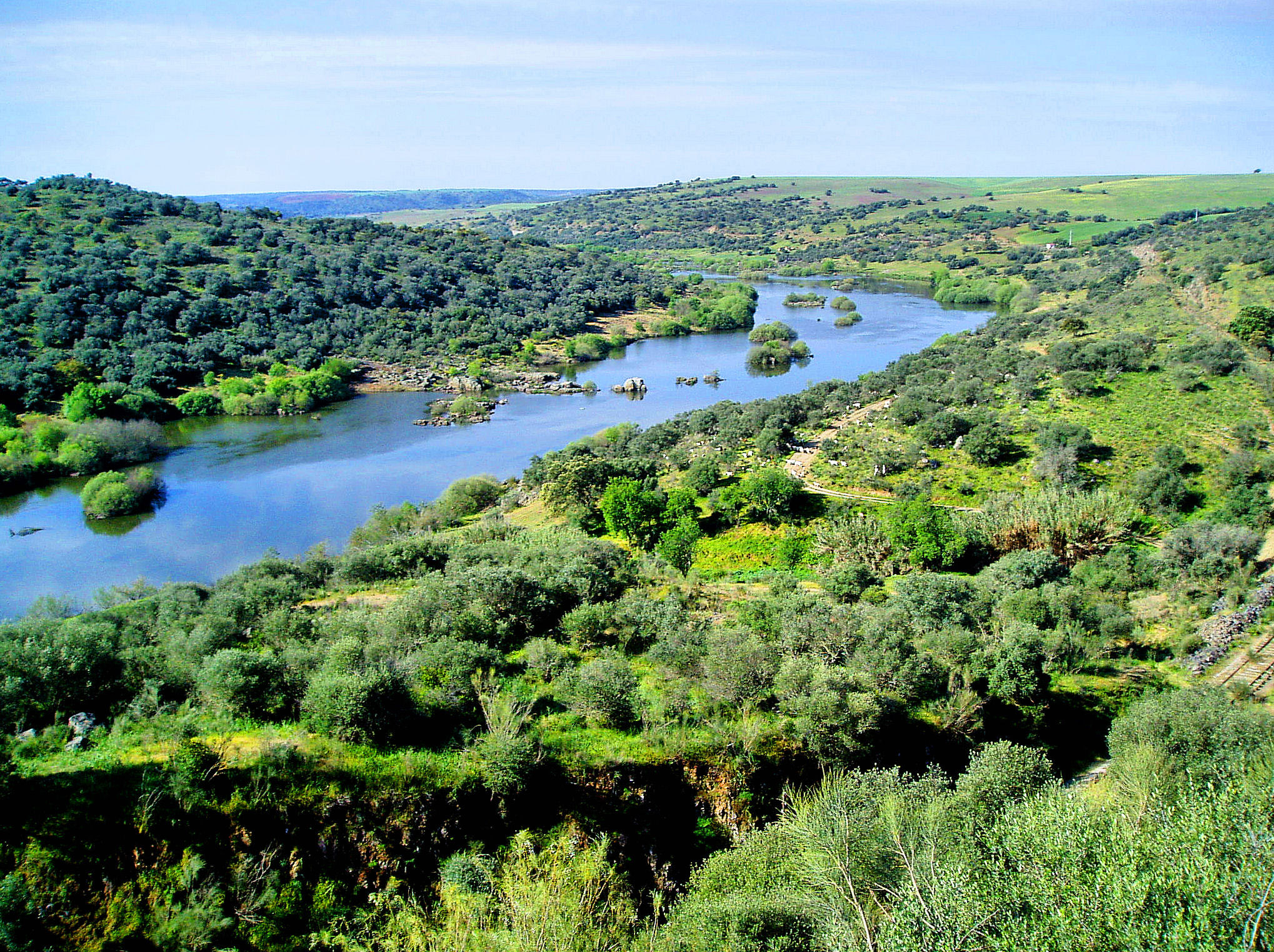
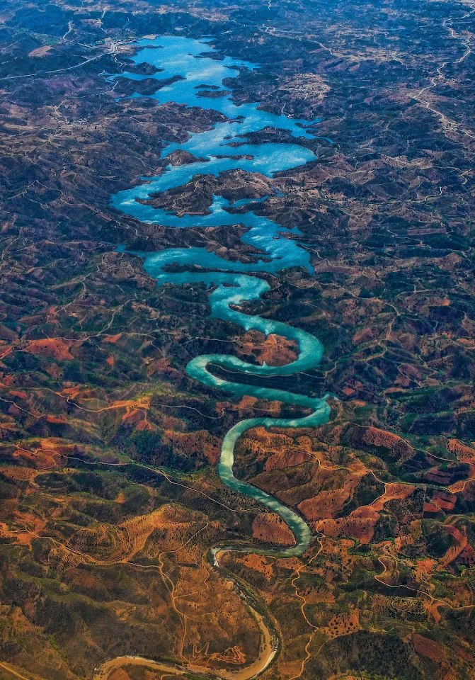
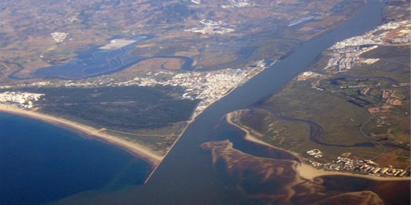
The Guadiana River rises of La Ruidera Lagunas, in the Spanish province of Albacete, to empty into the Atlantic, near Vila Real de Santo António and Ayamonte (Spain), covering a length of 830 kilometers. The area closest to the mouth of the estuary is the limit that marks the boundary between the water and the mainland or between the influences of sweet river water and salty ocean that create a wide variety of physical, chemical and biological components. It can be daily, depending on the action of the tide, flood or ebb; or seasonal, in the rain can overwhelm dry areas at other times and cause large variations in the relationship between fresh water and salt water; or else resulting from human activity, with discharges from dams. Although present serene, the bed of the Guadiana, may undergo changes and take on different characteristics, which enables the variation of species. The Guadiana tributaries are geralemente, streams formed by the action of rain, which makes your average low compared to most flow Iberian rivers, but its features are similar to the Mediterranean rivers. Down the Guadiana, freshwater predominates to the Alamo, a buffer zone that extends to the point of Odeleite flows of Ribeira and dominance becomes salt water. Around the Guadiana bed extend moist, flat areas in the first 10 kilometers from the Foz, the sand or clay land form the marshes and in the most irregular areas from that point to the Alcoutim area ios land are schist and gravel. Successively occupied the banks of the Lower Guadiana, the Phoenicians (the eighth century BC) and the Greeks (two centuries later) led the way followed by Carthaginians, Romans and Arabs, who used the river as penetration via the southwest of the Iberian Peninsula . These times the river was navigable until Mértola, creating an intense transport of goods, such as ores, wheat, leather, honey, olive oil, salt or fish. But Guadiana become was the border between Portugal and Spain after the Christian occupation in the Algarve, in the thirteenth century and Andalusia in the fifteenth century, while other areas were occupied by the Moors, as Ayamonte in 1239 and Castro Marim and Cacela in 1240. in the late twentieth century, the Guadiana continued to be important for marketing and nowadays, is seen only as a place to enjoy their landscape and environmental fullness.
An important area for birds is the Lagoa dos Salgados, with a small lagoon system that is assumed with larger during the rainy season. It is composed of small islands of vegetation, hydrophilic and halophilic plants, allowing the presence of a wide range of species waders to smaller, in particular Kentish Plover, the leg-long, Flamingo or colhereiro.